Applying weather prediction and soil moisture data to halt desert locust infestations
Interested in this FREE data set?
In recent months, huge swarms of desert locusts have been devastating crops in Africa, the Arabian Peninsula, and South Asia. This outbreak is the worst of its kind in decades and is severely impacting food security in the affected regions. Here is an image from the UN’s Food and Agriculture Organization (FAO) showing how widespread the invasion could be:
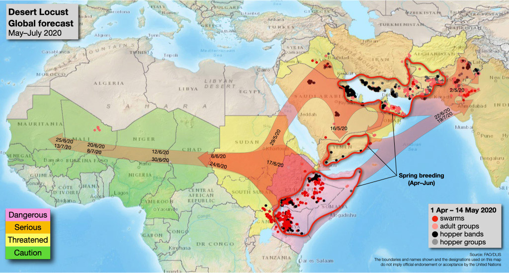
Image depicting the potential spread of the invasion. (source: UN’s Food and Agriculture Organization (FAO))
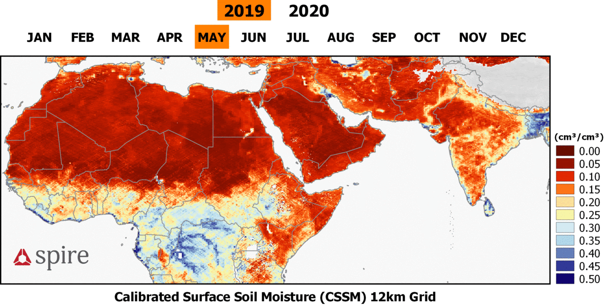
Inhibited by travel and shipping restrictions due to COVID-19, researchers and response teams have been utilizing remote sensing technologies to help mitigate the spread of these insects and limit the damage inflicted on local communities. Since eggs are laid in the soil and require sufficient moisture to survive, ground-penetrating radar and weather prediction data are essential to detecting breeding areas and eventually culling the locust populations. Below is a visualization of Spire Weather’s 7-day forecast for these parts of the world, showing soil moisture percentage at a depth of 0 to 10 centimeters (up to 2 meters depth is available in the full forecast):
Spire Weather’s 7-day forecast in the affected region including soil moisture. (source: Spire Global)
In addition to numerical weather prediction, Spire has also been developing an observed soil moisture solution that integrates data from NASA satellites with brand new data from our own fleet of cube-sats. Such satellites use a technique called GNSS-Reflectometry to collect and interpret radio signals that have reflected off of the earth’s surface. These radio signals, originating from GPS and other global navigation satellite systems (GNSS), have wavelengths which allow them to penetrate into the soil even when there is some vegetation present. The reflections measured by the satellites are then analyzed to determine soil moisture content, with more reflective areas indicating greater amounts of moisture.
Spire’s observed soil moisture solution applied to the affected area (source: Spire Global)
The above animation shows a 12km grid with less than 1km spatial resolution in ideal conditions (i.e. flat land surfaces). This offers greater detail than SMAP data, which provides soil moisture measurements at a spatial resolution of 36km. Although Spire’s solution incorporates data from NASA’s CYGNSS mission, Spire’s own GNSS-Reflectometry payloads are theoretically capable of collecting 4 to 8 times the number of simultaneous reflections.
Learn more about Spire’s Earth Information data, and if you think you might benefit from these improvements, contact us to inquire about beta testing this novel data resource.